The inhabitance of humans in these hills started earlier that the Roman period when several fragments of pottery were found in an area of Soglio, near the ancient Fonte in Canatra.

Map: https://www.viamichelin.com/web/Maps


Images from www.castellucciodinorcia.it
It was in the first half of the 17th century that bronze coins were located in the basement of a building in the country. There was a portrait of Emperor Claudius II Gothicus (268 – 270 AD) on these coins.

Image from Britanicca.com
Even more interesting, an undated tomb of a soldier was situated not far from the road that leads to the Forca di Presta. Some aerial views of this unique place suggested that there was an ancient castle at the peak of the country (Cordella– Lollini).


Image from https://www.dreamstime.com/photos-images/forca-di-presta.html
Pastoralism is originally the main livelihood in Castelluccio. Deforestation of the hills began to make way for new pastures and woods used for building and heating materials. What once used to be stables and barns has turned into a large paved square with buildings to welcome visitors who visit Castelluccio.
There are written languages on the wall of white paint, with their meaning unknown to those unfamiliar with the dialect. At the top of the hills called ‘painting’, you will reach the village’s oldest country.
An especially large and imposing old sixteenth-century fort serves as an entrance that leads you to the square of the church of Santa Maria Assunta of 1500.


Images from https://thepalladiantraveler.com/good-sights/italy-umbria-castelluccio-di-norcia
Castelluccio, for 1000 years had prided itself as a beautiful hilltop town as one of the most celebrated places called The Piano Grande.

Top view of Piano Grande: image from hotelgio.it

Image from: thepalladiantraveler.com/good-sights/italy-umbria-castelluccio-di-norcia
Straddling the central Italian regions of Le Marche and Umbria, The National Park of the Sibillini Mountains protects the mountain of the same name, which include the highest peak of the Umbria-Marche Apennine, the Monte Vettore (2476m), and the surrounding hilly landscape, dotted with medieval villages, castles and abbeys, farms and cultivated fields.

Sibillini Mountains from touring-italy.net

Monte Vettore
Photo from : italia.it/en/travel-ideas/the-mountains/monti-sibillini-national-park.html#prettyPhoto
Sadly, three major earthquakes struck central Italy in 2016, the first one on August 24, and then again on October 26 and 30. Those were the strongest quakes in 35 years and Castelluccio was the epicenter of the disaster, measuring 6.6 magnitudes.
Areas that were hit hard include towns like Arquata del Tronto and Castelluccio, both located inside the national park and were completely or largely destroyed. It took the lives of 300 people across the region, buildings are shattered and roots collapsed, literally making it looked like a war zone.

Photo by: yahoo.com

Photo by: Associated Press
The quake was a normal fault slip. The simple history of plate tectonics is that Africa is colliding small with Europe; however some small plate segments are caught between the collision of the two larger plates, The Apulia Plate (or Adriatic) underlies the northeast edge of Italy. The collision zone on the southwest side of this plate has formed the Apennines Mountains.

The pileup in the collision zone has caused normal slip faulting to develop within the range. These normal fault segments are not long, but they are generally shallow. Hence, when the slip took place near Norcia and Castelluccio the proximity of the movement combined with the gravity wall, Mansory construction proved to be very damaging.

Source: Scorcca (2003)
How recurring the intervals on these types of faults are not known. In recent years several damaging and deadly earthquakes have struck areas of Italy that had no previous historic damaging seismic events. This has caused a shift in risk approach – but a huge challenge gave the centuries of stone construction.
A year after the devastating quake, visitors are allowed to enter the area. The red zone marks are barricaded as too dangerous.

Image from tripadvisor.com
However, an exception was given for people to be able to see ‘’La Fioritura’’ (meaning flower), which prided a beautiful view of wildflowers in the meadows of the Piano Grande. Lentils, cornflowers, and poppies color the 16 square kilometer plains surrounded by Sibillini mountains.

Photo from: insider.com
The residents who have not left, believing in the value of their region, in its natural beauty and centuries-old traditions, have gotten together to find ways to rebuild and attract tourists again. Almost two years later, 90% of accommodation facilities within the park have reopened, and most trails have as well. It was the resilience of the local people that have made it possible. You will be convoyed to drive up the highlands to experience the amazing view of the landscape.

Castelluccio di Norcia. Photo by Filippo Chinell
Along the journey, you can see first hand, the impact of the earthquake. Once you reach the high ridge, trekking downs the plains will take a few hours. While walking down you will see a very deep crack, about 1 meter wide and black, an impact which was caused by the strong earthquake.

Photo from: https://www.bbc.com/news/world-europe-40554843
The walk down will be worth it as you see the breathtaking view of the fields of lentils and poppies which bloom every year, carpeting the landscape with a colorful quilt of blossoming flowers.
Every summer, this phenomenon is viewed by thousands before the earthquake but after this disaster, was visited only by hundreds. There are more beehives that people in the fields. It is here that the farmers of Castelluccio plant their lentils, a crop that has become very famous amongst foodies all over the world.

Photo from: https://thepalladiantraveler.com/good-sights/italy-umbria-castelluccio-di-norcia/
Because of the lack of help from the state, rebuilding the village to its original state is almost impossible. Though many inhabitants have to be evacuated, forcing the total closures of all roads during the earthquake in 2016 & 2017, over the years some hardy souls chose to stay and rebuild farming and sheep husbandry.
As of 2018, the village can be reached again, and temporary buildings have been erected, housing bars, and shops.

Photo from http://www.umbriantravel.com/?p=380

Lorenzo and Monia run a stall in the shadow of Castelluccio (Photo: https://www.bbc.com/news/world-europe-40554843)
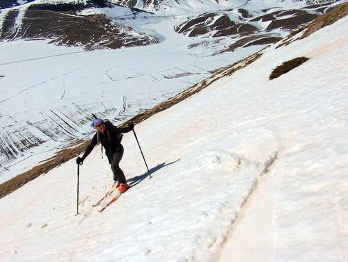
Now there is a lot of ski and trekking activities for the adventurous. If you choose something more relaxing, there is always something else to do to admire the beauty of this unique village.

Photo from: summitpost.org
Sources :
History (in short) of Castelluccio di Norcia (castellucciodinorcia.it)
The Colourful Blooms of Castelluccio, Italy (theatlantic.com)
Italian tourist treasure turned into a ghost town by an earthquake)
After the Quake (Everett Potter’s Travel Report)
Castelluccio (Norcia) - Wikipedia


